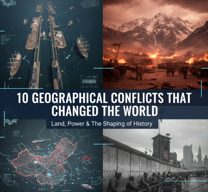
Throughout history, borders, territories, and natural resources have sparked some of the most significant conflicts humanity has ever witnessed. These geographical disputes didn’t just redraw maps—they transformed societies, shifted global power, and created ripple effects that still influence our world today. From ancient empires fighting over fertile river valleys to modern nations clashing over oil-rich regions, geography has always been destiny. Let’s explore ten pivotal territorial conflicts that fundamentally altered the course of human civilization.
The Scramble for Africa: Europe’s Colonial Land Grab (1881-1914)
Picture a continent rich in resources, diverse cultures, and ancient kingdoms. Now imagine European powers descending upon it like vultures, carving it up with barely a thought for the people living there. This was the Scramble for Africa, and it changed both Africa and the world forever.
Before 1881, Europeans controlled only about 10% of African territory. By 1914, they controlled 90%. Belgium, Britain, France, Germany, Italy, Portugal, and Spain drew arbitrary lines on maps, creating borders that ignored ethnic groups, traditional kingdoms, and natural boundaries. The Berlin Conference of 1884-1885 formalized this division, with European leaders literally sitting around a table deciding who got what—without a single African representative present.
How It Changed Everything
The Scramble for Africa didn’t just steal land and resources. It destroyed existing political systems, forced different ethnic groups into artificial nations, and extracted wealth that could have developed African societies. Even today, many African conflicts trace back to these colonial borders. Countries like Rwanda, Sudan, and Nigeria struggle with ethnic tensions because colonial powers lumped different groups together or split unified peoples apart.
The wealth extracted from Africa—gold, diamonds, rubber, and more—fueled Europe’s Industrial Revolution while leaving Africa impoverished. This created an economic imbalance between continents that persists into the 21st century.
The Partition of India: Religion Divides a Subcontinent (1947)
When Britain finally left India in 1947 after 200 years of colonial rule, they left behind a bloodbath. The decision to split British India into two nations—Hindu-majority India and Muslim-majority Pakistan—based on religious lines seemed simple on paper. In reality, it became one of history’s largest and deadliest mass migrations.
Between 10 and 20 million people fled their homes, trying to reach the “right” side of the new border. Hindus and Sikhs rushed toward India, while Muslims fled to Pakistan. Along the way, violence erupted. Trains arrived at stations filled with corpses. Villages burned. Families were torn apart. Estimates suggest between 200,000 and 2 million people died in the chaos.
The Lasting Impact
The partition created immediate enemies. India and Pakistan have fought four wars since 1947, primarily over the disputed Kashmir region. Both nations now possess nuclear weapons, making their conflict one of the most dangerous flashpoints on Earth.
Beyond the wars, partition left psychological scars on both nations. Families remain divided across borders. The refugee crisis created generational trauma. And the idea that religious identity should determine national boundaries influenced other conflicts worldwide, from the Israeli-Palestinian dispute to the Balkans.
| Partition of India Statistics | Numbers |
|---|---|
| People Displaced | 10-20 million |
| Estimated Deaths | 200,000 – 2 million |
| New Border Length | 2,900 kilometers |
| Years Since Partition | 77 years |
| Wars Fought Since | 4 major conflicts |
The Sykes-Picot Agreement: Drawing Lines in Middle Eastern Sand (1916)
While World War I raged, two diplomats—Britain’s Mark Sykes and France’s François Georges-Picot—met in secret. Their mission? Divide the Ottoman Empire’s Middle Eastern territories between their countries. Their method? Literally drawing lines on a map with little regard for the region’s complex tribal, ethnic, and religious makeup.
This agreement, signed in 1916, created the modern Middle East. France got control over Syria and Lebanon. Britain took Iraq, Jordan, and Palestine. They drew straight lines across deserts and through mountains, creating artificial nations that mashed together Sunnis, Shiites, Kurds, Christians, and dozens of other groups who had their own identities and histories.
Why This Still Matters Today
Look at any modern Middle Eastern conflict, and you’ll find Sykes-Picot’s fingerprints. Iraq’s internal divisions between Sunni, Shiite, and Kurdish populations stem from throwing these groups together. Syria’s civil war has sectarian dimensions rooted in these artificial borders. The Kurdish people, promised their own nation, ended up split among Turkey, Iraq, Syria, and Iran—still fighting for independence today.
ISIS explicitly rejected Sykes-Picot borders, bulldozing the boundary between Iraq and Syria to create their “caliphate.” The agreement didn’t just draw bad borders; it broke promises to Arab leaders who had fought against the Ottomans, creating lasting distrust of Western powers throughout the region.
The Israeli-Palestinian Conflict: Two Peoples, One Land (1948-Present)
Few territorial disputes match the complexity, emotion, and global attention of the Israeli-Palestinian conflict. At its heart lies a simple but seemingly impossible question: Who has the right to live in the land between the Mediterranean Sea and the Jordan River?
After World War II and the Holocaust, international support grew for creating a Jewish homeland. In 1947, the United Nations proposed dividing British Palestine into Jewish and Arab states. Jewish leaders accepted; Arab leaders rejected the plan, leading to war in 1948. Israel won, expanded beyond the UN’s proposed borders, and about 700,000 Palestinians fled or were expelled—an event Palestinians call the “Nakba” (catastrophe).
The Conflict’s Global Reach
This isn’t just a regional dispute. The Israeli-Palestinian conflict influences global politics, American foreign policy, and relations between Muslim and Western nations. It’s sparked multiple wars involving Egypt, Syria, Jordan, and Lebanon. It’s inspired peace movements and terrorist organizations. It’s consumed billions of dollars and countless lives.
The conflict remains unresolved because it involves competing claims to the same land, religious significance for Jews, Christians, and Muslims, refugee rights, security concerns, and deep historical grievances on both sides. Jerusalem, sacred to three major religions, sits at the conflict’s emotional core. Settlements, borders, water rights, and recognition—every issue seems intractable.
The Sino-Indian Border Dispute: Giants Collide in the Himalayas (1962-Present)
High in the Himalayan mountains, the world’s two most populous nations face off over a desolate, freezing border region. The Sino-Indian border dispute might seem like a conflict over worthless territory—who wants frozen wastelands at 15,000 feet elevation? But to China and India, these borders represent national pride, strategic advantage, and historical justice.
The main disputed areas are Aksai Chin (which China controls but India claims) and Arunachal Pradesh (which India controls but China claims). In 1962, tensions exploded into a brief but decisive war that China won, humiliating India and establishing positions both sides still hold today.

Modern Consequences
This isn’t ancient history. Chinese and Indian troops clashed violently in 2020, with soldiers fighting hand-to-hand combat because both sides avoid using guns to prevent escalation. At least 20 Indian soldiers and an unknown number of Chinese troops died—making it the deadliest border clash in 45 years.
Both nations are now nuclear powers with massive armies. Both are rising economic powers competing for influence across Asia. Their unresolved border dispute forces both countries to station thousands of troops in harsh conditions, drains resources that could be spent on development, and creates a potential flashpoint that could affect billions of people.
The Korean War: A Peninsula Divided by Ideology (1950-1953)
The Korean War started as a geographical conflict but became a frozen ideological battle line. After World War II, Korea—previously occupied by Japan—was divided at the 38th parallel. The Soviet Union controlled the north, and the United States controlled the south. This temporary division became permanent when both halves established separate governments.
In 1950, North Korea invaded South Korea, trying to reunify the peninsula under communism. The United States and UN forces intervened, pushing North Korean forces back to the Chinese border. Then China entered the war, pushing UN forces back south. After three years and millions of deaths, both sides agreed to a ceasefire—but never a peace treaty.
A Conflict Frozen in Time
Today, the Korean Demilitarized Zone (DMZ) remains one of the world’s most fortified borders. Families remain divided after 70 years. North Korea developed nuclear weapons, partly from feeling threatened by this unresolved conflict. South Korea hosts American troops to this day.
The war demonstrated how Cold War superpowers would fight proxy battles through smaller nations. It showed that nuclear weapons made direct war between major powers too risky, so they’d fight through allies instead. This pattern repeated in Vietnam, Afghanistan, and elsewhere.
| Korean War Impact | Details |
|---|---|
| Duration | 3 years (1950-1953) |
| Deaths | 2.5-3.5 million total |
| Current Border | 38th Parallel (DMZ) |
| Peace Treaty | Never signed |
| Countries Involved | North Korea, South Korea, China, USA, 15+ UN nations |
The Falklands War: Islands Worth Fighting For? (1982)
In 1982, Argentina invaded the Falkland Islands, a remote British territory in the South Atlantic. The islands were home to about 1,800 people and millions of sheep. Why fight over such a tiny, distant place? Because geography isn’t just about the land itself—it’s about national pride, resources, and strategic position.
Argentina had claimed the islands (which they call Las Malvinas) since Britain seized them in 1833. Britain considered them British territory whose residents wanted to remain British. When Argentina’s military government invaded, Britain sent a naval task force 8,000 miles to retake them. After 74 days and nearly 1,000 deaths, Britain won.
Why Small Conflicts Matter
The Falklands War proved that even in the modern era, nations would fight wars over remote territories. It showed that military force could still settle disputes, despite hopes that diplomacy had replaced warfare. The conflict bolstered British Prime Minister Margaret Thatcher’s career but led to Argentina’s military government collapsing.
The islands remain British, but Argentina never dropped its claim. The conflict also raised questions about who owns resources around territories—the seas around the Falklands might contain oil, making this frozen conflict potentially explosive again.
The Scramble for the Arctic: The Next Great Territorial Race (2000s-Present)
Climate change is creating a new geographical conflict, one that’s literally emerging from melting ice. As Arctic ice disappears, new shipping routes open and access to oil, gas, and mineral resources becomes possible. Russia, Canada, Denmark (via Greenland), Norway, and the United States all claim overlapping parts of the Arctic, and tensions are rising.
Russia has planted flags on the Arctic seabed, built military bases in the region, and claims vast territories. Canada insists certain passages are Canadian waters. Denmark argues that underwater ridges connect Greenland to the North Pole, giving it rights there. Meanwhile, China—despite not bordering the Arctic—declares itself a “near-Arctic state” seeking access.
The Stakes Are Enormous
The Arctic might contain 13% of the world’s undiscovered oil and 30% of its undiscovered natural gas. New shipping routes through the Arctic could cut transit times between Europe and Asia by 40%. Melting ice makes resources more accessible just as the world needs them more.
Unlike historical territorial conflicts settled by war, Arctic nations are (so far) using international law, scientific surveys, and diplomacy. The United Nations Convention on the Law of the Sea provides frameworks for resolving claims. But as resources become more valuable and accessible, the temptation to use force might grow.
Crimea and Eastern Ukraine: Europe’s Frozen War (2014-Present)
In 2014, Russia shocked the world by annexing Crimea from Ukraine, then supporting separatists in eastern Ukraine. This violated fundamental post-World War II principles: that borders should not be changed by force, and that nations shouldn’t invade their neighbors to seize territory.
Russia justified its actions by claiming to protect Russian-speaking populations and citing Crimea’s historical ties to Russia. Ukraine and most of the world condemned it as illegal aggression. The conflict killed over 14,000 people before Russia’s full-scale invasion of Ukraine in 2022 escalated it dramatically.
Why This Conflict Matters Globally
The Crimea annexation and eastern Ukraine conflict represent the first time since World War II that a major power forcibly changed European borders. This challenged the entire post-war international order. It led to sanctions against Russia, strained East-West relations back to Cold War levels, and showed that geographical conflicts could still trigger major power confrontations.
The conflict has implications beyond Europe. If major powers can seize territory without serious consequences, what stops China from taking Taiwan, or other nations from pursuing territorial claims by force? The Ukraine conflict tests whether the international community can still defend borders and sovereignty.
The South China Sea: Tiny Islands, Massive Implications (2010s-Present)
Scattered across the South China Sea are hundreds of tiny islands, reefs, and rocks. Some barely peek above the waves at high tide. Yet they’ve become the center of one of the world’s most dangerous territorial disputes, involving China, Vietnam, the Philippines, Malaysia, Brunei, and Taiwan.
China claims nearly the entire South China Sea based on historical usage, marked by their “nine-dash line.” Other countries claim territories based on international law giving them rights to nearby waters. To strengthen its position, China has literally built islands on reefs, constructing military bases where only coral existed before.
Why These Tiny Islands Matter So Much
The South China Sea holds several trillion dollars’ worth of oil and gas. More importantly, one-third of global shipping passes through it—over $3 trillion in annual trade. Whoever controls the South China Sea controls vital trade routes connecting Asia to the world.
China’s island-building and military presence in the region worries its neighbors and the United States, which guarantees freedom of navigation there. The Philippines took China to international court and won, but China ignored the ruling. Regular standoffs between ships and aircraft make the South China Sea a potential trigger for a major conflict involving nuclear powers.
How Geographical Conflicts Shape Our Future
These ten conflicts reveal patterns that help us understand how geography shapes human destiny. First, artificial borders created by external powers almost always create lasting problems. The Scramble for Africa, the Partition of India, and Sykes-Picot all drew lines without considering the people living there, and we’re still dealing with the consequences.
Second, resources matter immensely. Whether it’s Africa’s minerals, the Middle East’s oil, or the Arctic’s gas, valuable resources turn otherwise overlooked territories into conflict zones. As resources become scarcer due to climate change and growing populations, expect more geographical conflicts.
Third, national pride often outweighs practical considerations. The Falklands War was economically irrational for both sides, but national honor demanded fighting. Similarly, China and India maintain expensive military deployments in the Himalayas partly because backing down would seem weak.
Fourth, unresolved conflicts rarely disappear—they freeze and occasionally reignite. Korea remains divided after 70 years. The Israeli-Palestinian conflict continues after 75 years. Crimea might remain contested for generations.
Finally, international law and organizations matter, but they can’t solve conflicts when major powers oppose them. The UN can’t force solutions in Syria or Ukraine when permanent Security Council members have opposing interests.
Where Do We Go From Here?
Geographical conflicts will continue shaping our world. Climate change might trigger new ones as rising seas displace populations, desertification creates resource scarcity, and melting ice opens new territories. Growing populations competing for water, arable land, and resources could spark conflicts that make current disputes look minor.
Yet there’s hope. Europe fought wars over territory for centuries but has been largely peaceful since 1945. International institutions, while imperfect, provide frameworks for resolving disputes without war. Economic interdependence makes war costly—China and India trade billions annually despite their border dispute.
The key is learning from history. Artificial borders created by outsiders cause lasting problems. Respecting peoples’ rights to self-determination prevents grievances from festering. Sharing resources and waters fairly reduces conflict. Most importantly, recognizing that we share one planet means solving geographical conflicts through cooperation rather than conquest.
Geography is destiny, but humans write that destiny. The question is whether we’ll write it in ink through diplomacy and international law, or in blood through continued conflict.

Frequently Asked Questions
What causes most geographical conflicts?
Most geographical conflicts stem from disputed borders, competition over natural resources (oil, water, minerals), historical claims to territory, and ethnic or religious groups split by boundaries. Colonial-era borders drawn by European powers without considering local populations cause many modern conflicts.
Are geographical conflicts becoming more or less common?
Major wars over territory have decreased since World War II, but territorial disputes remain common. Climate change is creating new conflicts over resources like water and accessible Arctic territories. However, economic interdependence and international law provide more tools for peaceful resolution than in the past.
What’s the most dangerous current geographical conflict?
The Ukraine conflict and the South China Sea dispute are particularly dangerous because they involve nuclear powers or potential conflicts between nuclear powers. The Kashmir dispute between India and Pakistan also remains extremely dangerous as both nations possess nuclear weapons.
Can international organizations prevent geographical conflicts?
International organizations like the UN can mediate disputes and provide frameworks for peaceful resolution. However, they struggle when major powers oppose their decisions or when countries simply ignore international rulings. They work best when all parties want peaceful resolution.
How does climate change affect geographical conflicts?
Climate change intensifies resource competition (especially water), creates climate refugees who cross borders, opens previously inaccessible territories like the Arctic, and can make existing disputes worse. It’s likely to increase geographical conflicts unless nations cooperate on adaptation and resource sharing.
Why do countries fight over seemingly worthless territories?
Territories that seem worthless might contain resources, provide strategic military positions, control important waterways, or hold national symbolic importance. Even tiny, barren islands can establish claims to surrounding waters containing resources or shipping lanes. National pride also plays a major role.
What’s the best way to resolve geographical conflicts?
Successful resolutions usually involve: recognizing legitimate interests on all sides, using international arbitration, sharing resources fairly, respecting the wishes of local populations, establishing clear borders through negotiation, and creating economic incentives for peace that outweigh the benefits of conflict.