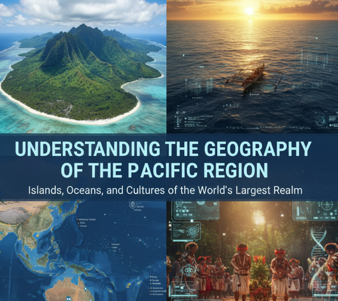
The Pacific Ocean covers more than 63 million square miles of our planet. That’s bigger than all the land on Earth combined. This massive body of water touches five continents and contains thousands of islands, deep ocean trenches, and some of the most active volcanoes on the planet. Let’s explore what makes this region so special and why it matters to billions of people around the world.
What Makes the Pacific Region So Huge?
The Pacific Ocean stretches from the Arctic in the north all the way down to Antarctica in the south. If you’re standing on the west coast of North or South America, you’re looking at the Pacific. Turn around and travel west across this ocean, and you’ll eventually reach Asia and Australia.
The Pacific covers about one-third of Earth’s surface. To put that in perspective, you could fit all seven continents inside the Pacific Ocean and still have room left over. It measures roughly 12,000 miles from north to south and about 11,000 miles at its widest point from east to west.
The Pacific’s Boundaries
The Pacific Ocean has natural borders that separate it from other oceans:
- North: The Bering Strait connects it to the Arctic Ocean between Alaska and Russia
- South: It merges with the Southern Ocean near Antarctica
- East: The coastlines of North and South America
- West: Asia, Australia, and numerous island chains
Major Island Groups Scattered Across the Pacific
Thousands of islands dot the Pacific Ocean, grouped into three main regions that scientists and geographers call Melanesia, Micronesia, and Polynesia.
Melanesia: Islands of Dark Soil
Melanesia sits in the southwestern Pacific. The name comes from Greek words meaning “black islands,” referring to the dark soil and the indigenous people who live there. Major island groups include:
- Papua New Guinea (the world’s second-largest island)
- Fiji
- Solomon Islands
- Vanuatu
- New Caledonia
These islands are mostly volcanic or continental, meaning they’re either formed from volcanoes or were once connected to larger landmasses.
Micronesia: The Tiny Islands
North of Melanesia lies Micronesia, which means “small islands.” This region contains more than 2,000 small islands spread across millions of square miles of ocean. Key areas include:
- Guam
- Marshall Islands
- Palau
- Federated States of Micronesia
- Kiribati
- Nauru
Many of these islands are coral atolls—ring-shaped islands that formed around ancient volcanoes that have since sunk beneath the waves.
Polynesia: The Triangle of Islands
Polynesia forms a huge triangle in the central and southern Pacific. Imagine three points: Hawaii in the north, New Zealand in the southwest, and Easter Island in the southeast. Everything inside that triangle is Polynesia.
Important island groups include:
- Hawaii (United States)
- Samoa
- Tonga
- French Polynesia (including Tahiti)
- Cook Islands
- Tuvalu
- New Zealand (often included due to Maori heritage)
The Ring of Fire: Where Earth Gets Explosive
One of the most important features of the Pacific Region is the Ring of Fire. This isn’t an actual ring of flames—it’s a 25,000-mile horseshoe-shaped zone where about 75% of the world’s volcanoes are located.
Why Does the Ring of Fire Exist?
Earth’s surface is made up of huge pieces called tectonic plates. These plates float on hot, semi-liquid rock and constantly move, though very slowly. The Ring of Fire follows the edges of the Pacific Plate, where it bumps into other plates.
When plates collide or slide past each other, three things can happen:
- Volcanic eruptions: Magma from deep inside Earth rises to the surface
- Earthquakes: Sudden movements of the plates shake the ground
- Mountain building: Plates pushing together create mountain ranges
Countries Affected by the Ring of Fire
The Ring of Fire runs along the coasts of:
- North America: Alaska, Canada, Western United States
- Central America: Mexico, Guatemala, El Salvador
- South America: Colombia, Ecuador, Peru, Chile
- Asia: Russia, Japan, Philippines, Indonesia
- Oceania: Papua New Guinea, New Zealand
Japan experiences about 1,500 earthquakes every year because of its location on the Ring of Fire. Indonesia has more active volcanoes than any other country—around 130.

Ocean Trenches: The Deepest Places on Earth
The Pacific Ocean floor isn’t flat. It contains some of the deepest places on our planet, called ocean trenches. These are long, narrow depressions formed where one tectonic plate slides beneath another.
The Mariana Trench: Earth’s Deepest Point
The Mariana Trench, located near Guam, contains the deepest known point on Earth—the Challenger Deep. It plunges down 36,070 feet (almost 7 miles) below sea level. If you put Mount Everest at the bottom of this trench, there would still be more than a mile of water above its peak.
Only three people have ever visited the bottom of Challenger Deep. The pressure down there is more than 1,000 times what we experience at sea level—enough to crush most submarines.
Other Major Pacific Trenches
| Trench Name | Location | Maximum Depth | Notable Features |
|---|---|---|---|
| Mariana Trench | Western Pacific | 36,070 feet | Deepest point on Earth |
| Tonga Trench | South Pacific | 35,702 feet | Second deepest trench |
| Philippine Trench | Off Philippines | 34,578 feet | Site of many earthquakes |
| Kermadec Trench | Near New Zealand | 32,963 feet | Extends from Tonga Trench |
| Kuril-Kamchatka Trench | Off Russia | 31,988 feet | Very seismically active |
Climate Zones Across the Pacific
The Pacific is so large that it spans every climate zone on Earth, from frozen Arctic waters to tropical paradises.
Tropical Pacific: Warm and Humid
Islands near the equator enjoy warm temperatures year-round, usually between 75°F and 85°F. These areas receive plenty of rain, supporting lush rainforests and coral reefs. Countries like Papua New Guinea, Solomon Islands, and many Indonesian islands fall into this zone.
Tropical Pacific islands face seasonal challenges. Cyclones (also called typhoons or hurricanes) form over warm ocean waters and can bring devastating winds and flooding.
Temperate Pacific: Four Seasons
Areas farther from the equator, like New Zealand, southern Australia, Japan, and the Pacific coast of the United States, experience four distinct seasons. Summers are warm, winters are cool, and these regions receive moderate rainfall throughout the year.
Polar Pacific: Ice and Cold
The far northern Pacific, near Alaska and Russia, and the southern Pacific near Antarctica, experience extremely cold conditions. Winter temperatures can drop well below freezing, and sea ice forms over large areas.
Major Currents That Move Water Around the Pacific
Ocean currents are like rivers flowing through the sea. They move warm and cold water around the Pacific, affecting weather patterns and marine life across the entire region.
The Pacific Gyre System
The Pacific has two major circular current systems called gyres:
North Pacific Gyre: This clockwise current system moves warm water from the tropics northward along Asia’s coast (the Kuroshio Current), then eastward across the Pacific, before cold water returns southward along North America’s coast (the California Current).
South Pacific Gyre: This counterclockwise system works similarly in the Southern Hemisphere, with the East Australian Current carrying warm water southward and the Peru Current bringing cold water northward along South America.
El Niño and La Niña: When the Pacific Changes Everything
Every few years, the Pacific Ocean undergoes dramatic changes that affect weather worldwide. These patterns are called El Niño and La Niña.
El Niño: Warm water that usually sits in the western Pacific spreads eastward. This causes:
- Heavy rains and flooding in South America
- Droughts in Australia and Indonesia
- Milder winters in North America
- Reduced hurricane activity in the Atlantic
La Niña: The opposite happens—cold water dominates the eastern Pacific. This typically brings:
- Drier conditions to South America
- Heavy rains to Australia and Indonesia
- Harsher winters in North America
- More active Atlantic hurricane seasons
Natural Resources That Make the Pacific Valuable
The Pacific Ocean provides essential resources for billions of people.
Fish and Seafood
The Pacific produces more fish than any other ocean. Important fishing areas include:
- Western Pacific: Tuna, mackerel, and sardines
- North Pacific: Salmon, pollock, and crab
- Eastern Pacific: Anchovies and hake
Millions of people depend on Pacific fisheries for food and income. However, overfishing threatens many species, and countries work together to manage fish populations sustainably.
Minerals and Oil
The ocean floor contains valuable minerals including:
- Oil and natural gas (especially near Southeast Asia and California)
- Manganese nodules (potato-sized lumps of metal on the deep ocean floor)
- Rare earth elements used in electronics
Renewable Energy
The Pacific’s waves, tides, and winds represent enormous potential for clean energy. Several countries are developing:
- Offshore wind farms
- Tidal power stations
- Wave energy converters
How People Live Across the Pacific Region
More than 2 billion people live along the Pacific’s shores, making it the most populated ocean region in the world.
Coastal Megacities
Some of the world’s largest cities sit on the Pacific coast:
- Tokyo, Japan (37 million people)
- Manila, Philippines (14 million)
- Los Angeles, USA (13 million)
- Shanghai, China (27 million)
- Lima, Peru (11 million)
These cities depend on the ocean for trade, food, and recreation. Major ports handle billions of dollars in cargo every year, connecting Asia with the Americas.
Island Life
For Pacific islanders, the ocean isn’t just nearby—it’s central to their identity and survival. Traditional practices include:
- Navigation: Ancient Polynesian sailors traveled thousands of miles using stars, waves, and bird behavior
- Fishing: Many communities still use traditional methods passed down for generations
- Cultural practices: The ocean features prominently in art, music, and spiritual beliefs
Environmental Challenges Facing the Pacific
The Pacific faces serious environmental threats that require global attention.
Plastic Pollution
The Great Pacific Garbage Patch is a massive area of floating plastic debris, roughly twice the size of Texas, located between Hawaii and California. Ocean currents concentrate plastic waste in this region, harming marine life and ecosystems.
Coral Reef Destruction
Rising ocean temperatures cause coral bleaching, where corals expel the algae they need to survive. The Pacific contains vast reef systems that support 25% of all marine species, but many reefs are dying.
-
🌏 Explore more: The Science Behind Earthquakes Explained Simply
Rising Sea Levels
Climate change is causing sea levels to rise, threatening low-lying Pacific islands. Some nations, like Tuvalu and Kiribati, may become uninhabitable within decades if trends continue. Their governments are already making plans to relocate entire populations.
Acidification
The ocean absorbs carbon dioxide from the atmosphere, making the water more acidic. This harms shellfish, corals, and many other marine organisms that build shells or skeletons from calcium carbonate.
Trade Routes That Connect Continents
The Pacific Ocean serves as a massive highway for global trade.
The Transpacific Trade Route
More than 60% of global trade crosses the Pacific, with goods moving between:
- Asia and North America
- Asia and South America
- Australia and Asia
Container ships carry everything from electronics to clothing to food across the Pacific. A single large container ship can carry over 20,000 containers, each the size of a truck trailer.
The Panama Canal Connection
The Panama Canal, opened in 1914, allows ships to travel between the Pacific and Atlantic oceans without sailing around South America. This shortcut saves weeks of travel time and has made Pacific trade more efficient.
Why the Pacific Region Matters to Everyone
Even if you don’t live near the Pacific, this ocean affects your life in many ways:
Weather Patterns: Pacific conditions influence rainfall and temperatures across the globe. El Niño events can cause droughts in Africa and floods in South America.
Food Security: Pacific fisheries feed hundreds of millions of people. When fish populations decline, food prices rise worldwide.
Economic Connections: Products you use every day likely crossed the Pacific at some point. Your smartphone, clothes, and toys probably came from Asia.
Scientific Research: The Pacific helps scientists learn about Earth’s climate, geology, and life. Deep-sea research reveals new species and helps us understand our planet’s history.
Cultural Heritage: Pacific peoples have developed unique cultures adapted to life on and around the ocean. These traditions offer valuable lessons about sustainability and living in harmony with nature.
What the Future Holds for the Pacific
The Pacific Region faces an uncertain future. Climate change, pollution, and overfishing pose serious challenges, but people around the world are working to protect this vital ocean.
Conservation efforts include:
- Marine protected areas where fishing is restricted
- International agreements to reduce plastic pollution
- Renewable energy projects to reduce carbon emissions
- Restoration projects to rebuild coral reefs
Young people today will play a crucial role in deciding the Pacific’s future. The choices we make now about energy, consumption, and conservation will determine whether future generations can enjoy this magnificent ocean’s resources and beauty.

Frequently Asked Questions
Q: How deep is the Pacific Ocean on average?
A: The average depth of the Pacific Ocean is about 13,000 feet (almost 2.5 miles). However, depths vary dramatically—from shallow coastal areas just a few feet deep to the Mariana Trench at over 36,000 feet deep.
Q: Why is it called the Pacific Ocean?
A: Portuguese explorer Ferdinand Magellan named it “Mar Pacifico” (peaceful sea) in 1520 because he encountered calm waters during his voyage. Ironically, the Pacific can be quite violent, with powerful storms and tsunamis.
Q: How many countries border the Pacific Ocean?
A: Approximately 50 countries and territories have Pacific coastlines. This includes major nations like the United States, China, Japan, Australia, Chile, and Canada, plus many smaller island nations.
Q: What’s the difference between a typhoon and a hurricane?
A: They’re the same weather phenomenon—tropical cyclones. We call them hurricanes in the Eastern Pacific and Atlantic, typhoons in the Northwestern Pacific, and cyclones in the South Pacific and Indian Ocean.
Q: Can you see across the Pacific Ocean?
A: No. Even from the highest coastal mountains, you can only see about 20-30 miles out to sea due to Earth’s curvature. The Pacific is over 11,000 miles wide at its broadest point.
Q: Why are there so many earthquakes in the Pacific?
A: The Pacific Plate and surrounding tectonic plates are very active. When these massive pieces of Earth’s crust move, they create earthquakes. The Ring of Fire experiences about 90% of the world’s earthquakes.
Q: Is the Pacific Ocean getting bigger or smaller?
A: The Pacific is actually shrinking by about one inch per year. The Atlantic Ocean is growing as the Americas move away from Europe and Africa. In about 200 million years, the Pacific might disappear completely as continents continue shifting.
Q: How cold is the water in the Pacific?
A: It varies widely. Tropical Pacific waters stay around 80°F year-round, while polar waters near Alaska and Antarctica can be as cold as 28°F (salt water freezes at a lower temperature than fresh water).
The Pacific Region represents one of Earth’s most important and impressive natural features. From its deepest trenches to its highest islands, from its microscopic plankton to its massive whales, this ocean system supports life on a scale that’s hard to imagine. By learning about the Pacific’s geography, we better appreciate its value and understand why protecting it matters for everyone on Earth.